
Understanding Vatnajökull history through the landscape
Vatnajökull history begins with a changing ice cap rather than an unaltered remnant of the last ice age. The park’s account describes mountain glaciers growing together, with modelling placing that process roughly 1,000 to 1,500 years ago. By the settlement period in 874 CE, a continuous ice cap was already present. That distinction helps explain why the glacier is a landscape with its own development, not simply a frozen backdrop that has remained the same throughout human history.
Today’s visit brings together several different stories: the formation of ice, the movement of water, the effect of volcanic heat and the development of access and protection. Keep those stories separate from present-day road and safety decisions. The glacier guide introduces the ice cap and outlet glaciers, while the national park guide explains the larger protected landscape. A historical description is a way to understand what is visible, rather than a route instruction.
Ice, volcanoes and glacial floods
Volcanic activity beneath the ice is central to this landscape. Heat below the glacier and eruptions can collect meltwater and trigger glacial outburst floods, known as jökulhlaups. Their effects extend beyond the ice margin into rivers, plains and gorges. Looking only at a glacier tongue misses this wider connection: the lowlands and waterways are part of the same landscape story. Water released from beneath ice can reshape places that appear far removed from the volcanic centre itself.
This interaction of ice and volcanic processes also helps explain the area’s World Heritage significance. It does not provide an eruption forecast or establish a current hazard level. Historical events and present warnings answer different questions. For the distinction between the ice cap and volcanic landscapes visited today, continue to the volcano overview. On a journey through the park, use the visible relationship between mountains, ice and plains to understand the setting without treating the scenery as evidence of safe access.
Our pick: a present-day glacier visit
Our take: This beginner-friendly guided walk includes the national park fee.
Hand-picked tours, booked through Viator. Prices are indicative starting prices in euros (as of October 2026). Tap a tour for live availability and the current price in your currency.
Experience the landscape today
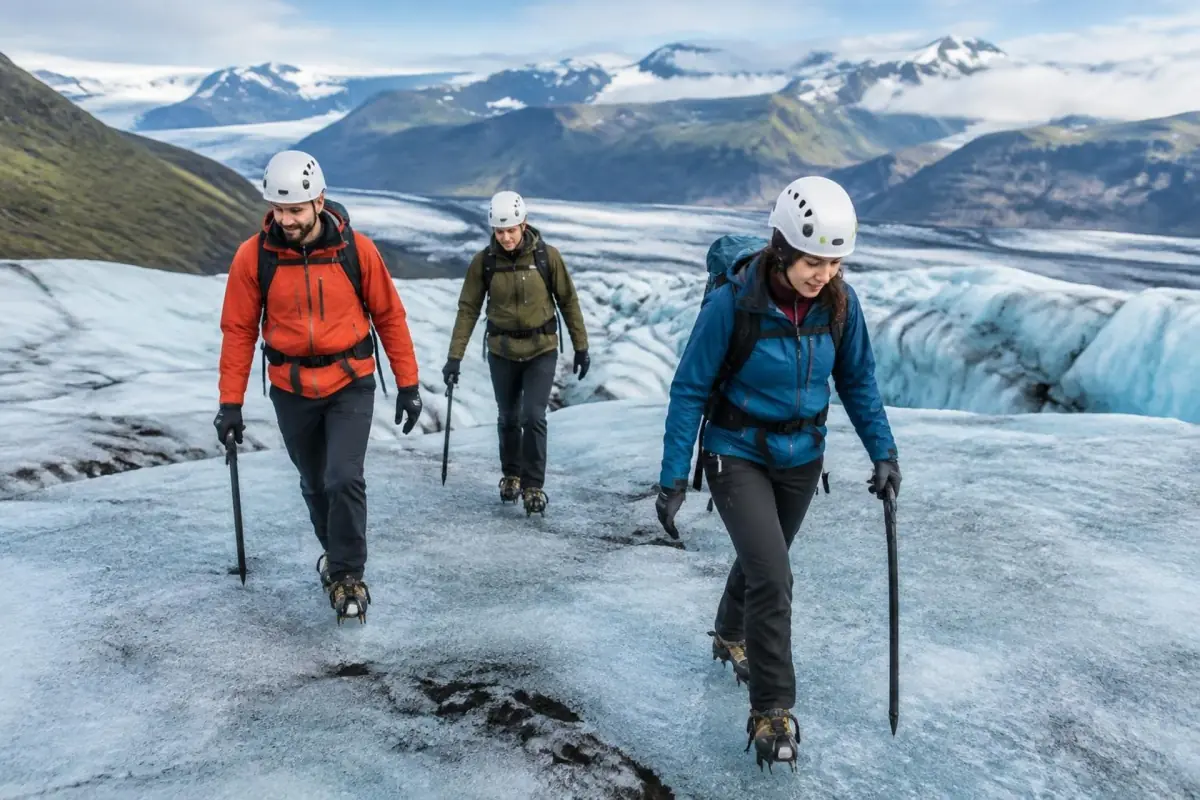
A guided glacier walk with a national park fee included offers a present-day visit to the ice landscape; meeting-point parking is separate.
The Skeiðará bridge and access in 1974
The construction of the bridge over Skeiðará in 1974 removed an important transport obstacle in the south. This date belongs to the history of reaching the region, alongside the physical story of water crossing the plains. The connection matters for a visitor: roads and bridges are part of how a changing natural landscape becomes accessible. The plain is more than empty space between stops, and the history of the crossing adds meaning to a journey that might otherwise be read only as a drive.
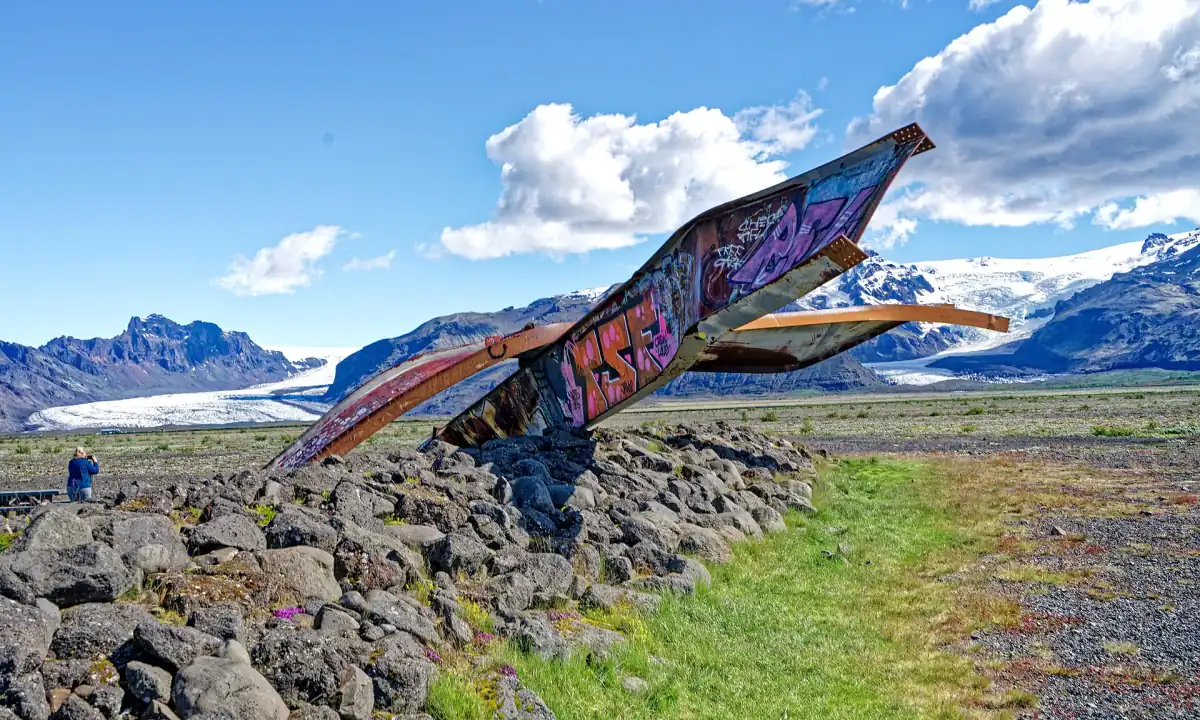
Flood processes in this area are connected with Grímsvötn and volcanic or geothermal heat. The relationship gives context to the engineering challenge without turning a historical crossing into a claim about today’s roads. For current travel planning, use the arrival guide and consult road.is, vedur.is and SafeTravel.is before driving. The photograph of twisted bridge remains illustrates the theme of infrastructure in this landscape; it should not be read as a notice that a present road is closed.
Retreating ice and the formation of lakes
The southern outlet glaciers are thinning and retreating. At Breiðamerkursandur, the park describes lakes developing from the 1930s as the glacier receded. This offers another way to read the landscape through time: water and exposed ground can occupy areas formerly covered by ice. A present photograph captures one stage in that change. Older views can help explain the process, but they are not a dependable map of the ice edge or access route for a visit today.
The park also discusses settlement history here through Landnáma and Íslendingabók. These historical accounts belong to a different kind of evidence from modern measurements. Avoid combining them into a precise reconstruction of every former shoreline or settlement. For a visitor, the useful connection is that people and ice have shared a changing environment. Leave the detailed lagoon visit to the relevant local guide and keep this page’s focus on the chronology that helps explain why today’s scenery looks as it does.
Protected landscapes and UNESCO in 2019
Skaftafell became protected in 1967 and has formed part of Vatnajökull National Park since 2008. Its protection history is one chapter within a much wider park. For the local walking area and its visitor organisation, see Skaftafell landscapes, walks and visitor planning. These dates explain how protection developed; they do not imply that every part of the modern park acquired its status at the same time or has identical visitor arrangements.
UNESCO inscription followed on 5 July 2019, recognising the interaction of volcanic and glacial processes. The World Heritage property, national park and glacier are different geographical objects, so their areas should not be used interchangeably. A present-day guided glacier walk offers a way to experience the landscape rather than a specialist history tour. The example here includes a certified glacier guide, equipment and a national park fee, with parking at the meeting point charged separately. Step onto glacier ice only with a certified, locally knowledgeable guide.
Frequently asked questions
Was the present ice cap unchanged since the last ice age?
The park describes mountain glaciers growing together to form today’s ice cap. A continuous ice cap was present by settlement in 874 CE.
Why does 1974 matter?
The Skeiðará bridge built that year removed an important transport obstacle in southern Iceland.
Is the visit example a history tour?
It is a guided glacier walk. Its inclusions cover a certified glacier guide, safety equipment and a national park fee, with meeting-point parking separate.